PAZ GAMES
1944 WWII World Map - D-Day Landings - Stanley Turner 22"x50" Waterproof Poster
1944 WWII World Map - D-Day Landings - Stanley Turner 22"x50" Waterproof Poster
Couldn't load pickup availability
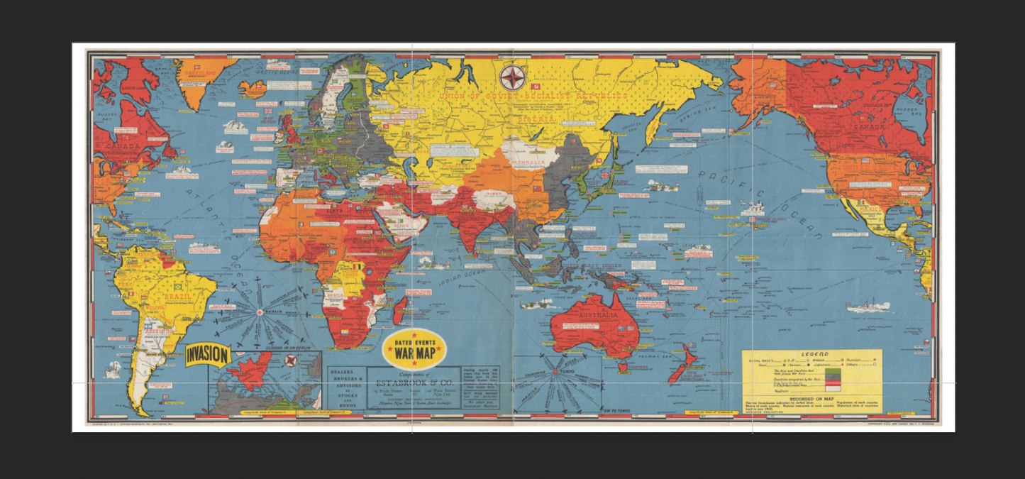
OWN A PIECE OF HISTORY, BUILT FOR MODERN LIFE – This stunning high-resolution reproduction of Stanley Francis Turner's iconic 1944 "Dated Events War Map" brings the drama of World War II right into your home or office. Unlike fragile originals, our version is printed on durable, waterproof material, perfect for everyday display.
This massive 22-inch by 50-inch map captures the entire world at a pivotal moment: the weeks leading up to the D-Day invasion. It is a fascinating snapshot in time, filled with the hope, anxiety, and strategic planning of the Allied war effort across every theater of the global conflict.
🔍 A CLOSER LOOK AT THE MAP:
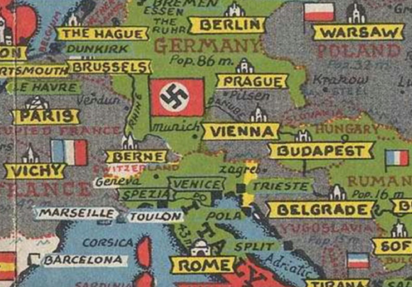
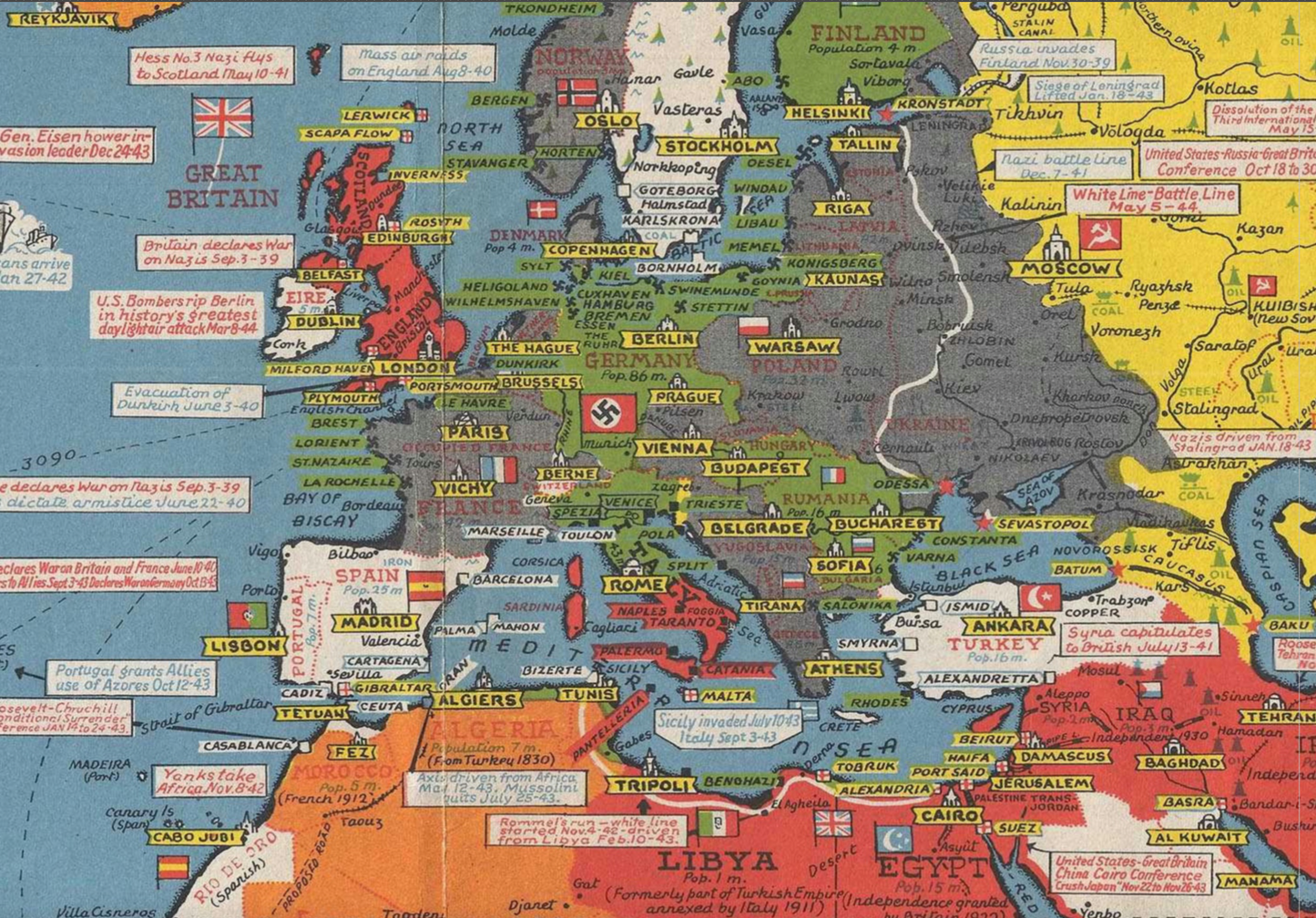
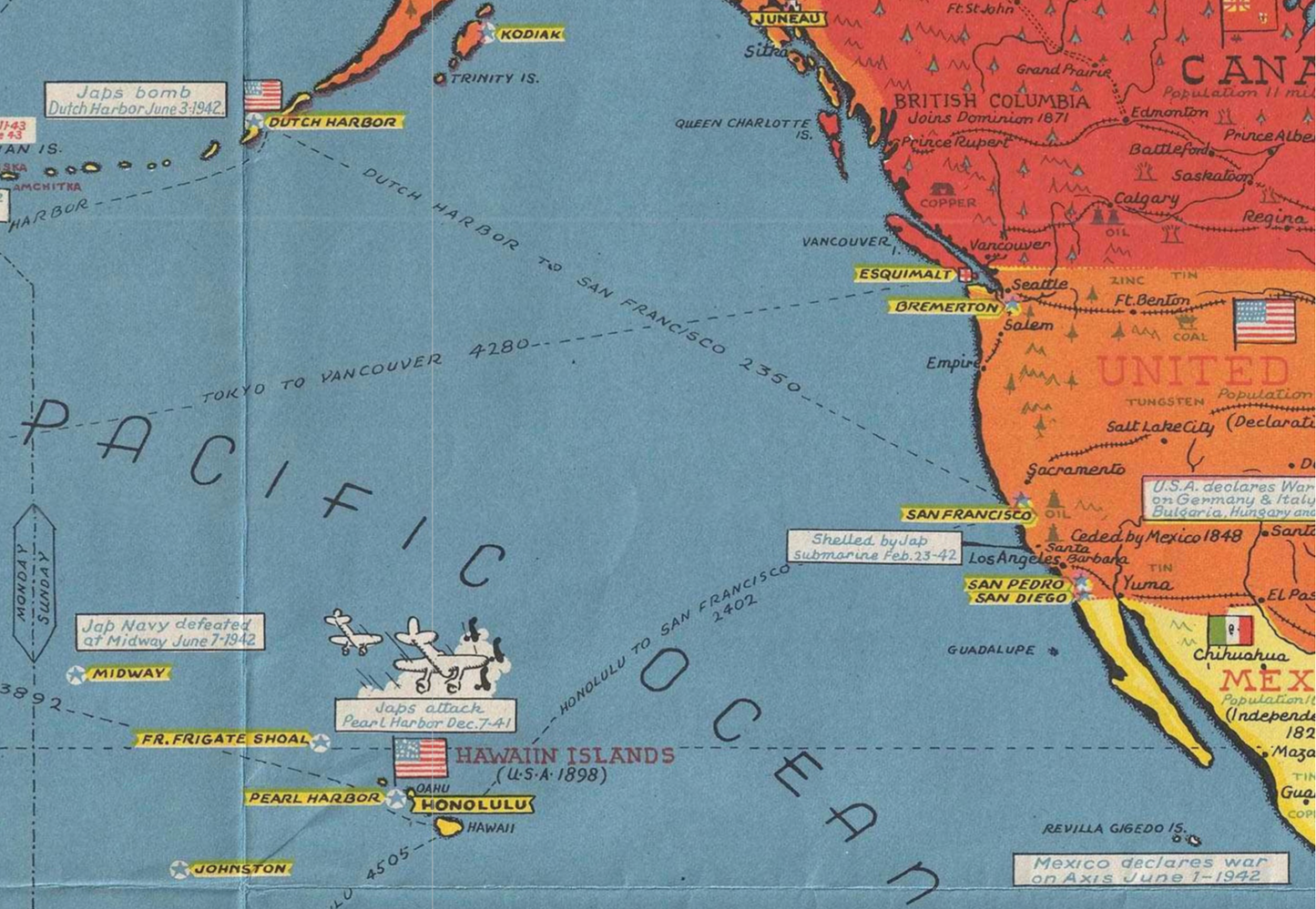
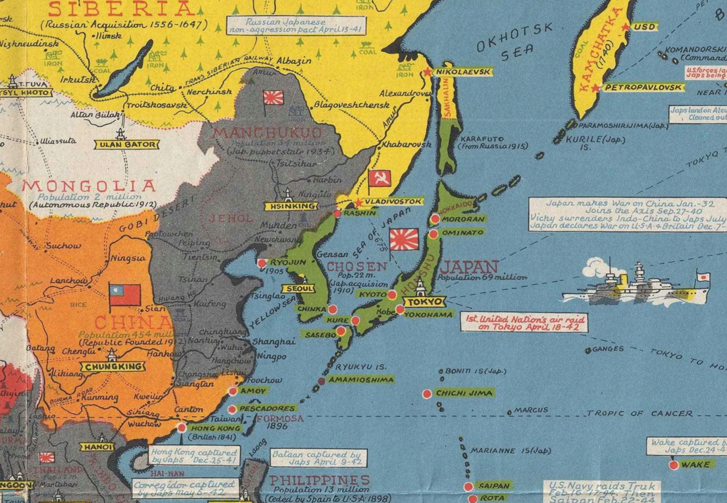
Originally drawn by artist Stanley Francis Turner and published by C.C. Peterson, this map was designed to help the public understand the complex global conflict. Our reproduction captures every incredible detail of this comprehensive world view:
-
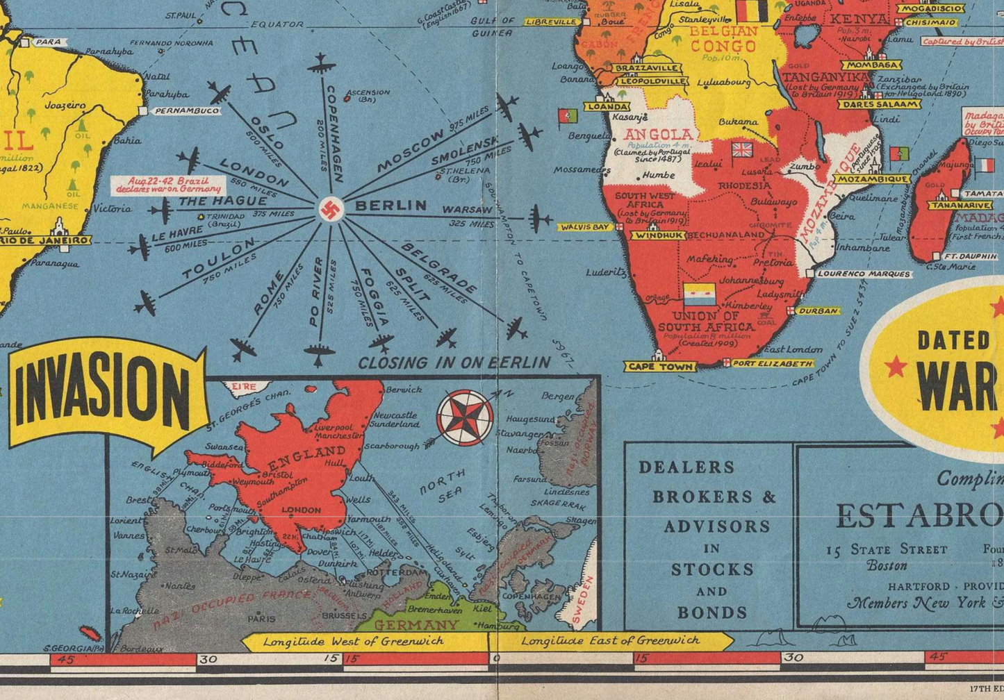
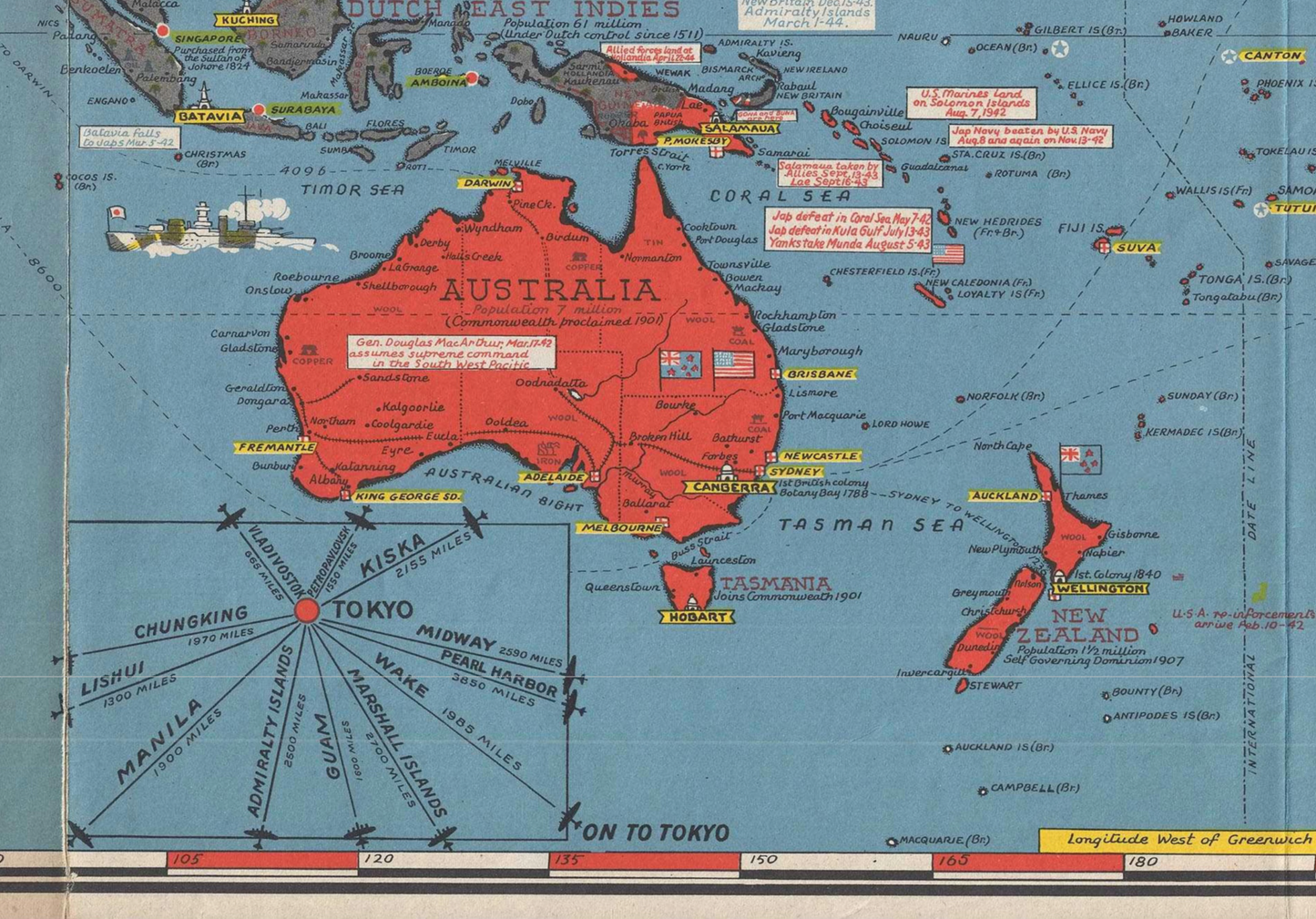
Global Theaters of War: Track the action across the entire globe—from the Pacific and Asia to Europe, Africa, and the Atlantic.
-
Color-Coded Nations: Axis powers in green, British Empire in red, United States in orange, and Allied nations like the USSR in yellow.
-
Historical Annotations: Dozens of text boxes detail key global events like the Fall of France, the North Africa Campaign, the Casablanca Conference, and the Lend-Lease Act.
-
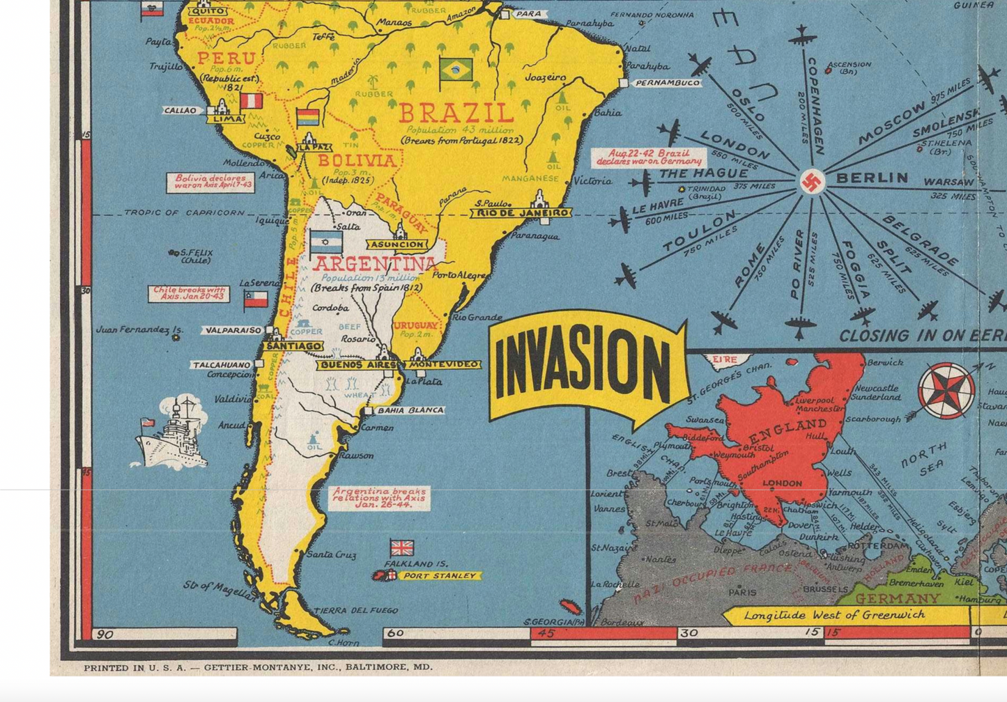
THE INVASION FORECAST: A key inset map along the bottom speculates on the possible Allied invasion routes across the English Channel to liberate Nazi-Occupied France, highlighting the strategic importance of the Normandy region.
-
"Closing In On Berlin" & "Distances to Tokyo": Unique graphics show bombing distances to Berlin from European capitals and distances to Tokyo from across the Pacific, highlighting the global scale of the Allied offensive.
-
Flags & Artwork: Features national flags, camouflaged ships, and detailed cartography of the entire world.
✨ WHY OUR VERSION IS THE BEST WAY TO OWN THIS MAP:
-
HIGH-RESOLUTION & CRYSTAL CLEAR: Digitally remastered from original sources to ensure every word, line, and symbol on this detailed world map is sharp and legible.
-
WATERPROOF & DURABLE: Printed on premium tear-resistant material. Spills, humidity, and sunlight won't damage it. Wipe clean with a damp cloth.
-
PERFECT FOR DISPLAY: Its unique, narrow format makes a dramatic statement in any room. Ideal for a home office, library, man cave, classroom, or history enthusiast's garage.
-
READY TO GIFT: A unique and thoughtful gift for any world history buff, veteran, or fan of military strategy.
📐 SPECIFICATIONS:
-
Overall Size: 22 inches x 50 inches (Approximately 4.1 feet wide!)
-
Scale: 1 : 32,000,000
-
Material: Premium Waterproof Vinyl
-
Features: Waterproof, Tear-Resistant, Matte Finish to reduce glare.
🎁 IDEAL FOR:
-
World History Enthusiasts & Collectors
-
D-Day & WWII Memorabilia
-
Unique Home & Office Decor
-
Teachers & Educators
-
A unique gift for Veterans, Fathers, and Graduates
We are confident you will love this unique and conversation-starting piece of global history. Add it to your cart now!
NOTE: Need a different size? Drop me a line.
Share